|
|
| Length: 2.1 miles | Type: One Way |
| Gain/Loss: +/-1710' | Difficulty: Hard |
| Location: South of Wrightwood |
| Trailhead: Acorn Drive / Blue Ridge Road |
|
|
|
|
| Length: 0.5 miles | Type: Loop |
| Gain/Loss: Unknown | Difficulty: Very Easy |
| Location: Big Pines |
| Trailhead: Big Pines Lodge |
|
|
|
|
| Length: 1.8 miles | Type: One Way |
| Gain/Loss: +255'/-0' | Difficulty: Easy |
| Location: South-West of Wrightwood |
| Trailhead: Vincent Gap |
|
|
|
|
| Length: 2.0 miles | Type: One Way |
| Gain/Loss: +/-1050' | Difficulty: Moderate |
| Location: West of Wrightwood |
| Trailhead: Big Pines / Blue Ridge Campground |
|
|
|
|
| Length: 4.6 miles | Type: Connecting |
| Gain/Loss: +/-2530' | Difficulty: Hard |
| Location: South of Wrightwood |
| Trailhead: Backbone Trail / Fish Fork Trail |
|
|
|
|
| Length: 4.6 miles | Type: One Way |
| Gain/Loss: +635'/-1260' | Difficulty: Moderate |
| Location: South of Wrightwood |
| Trailhead: Lupine Campground |
|
|
|
|
| Length: 0.8 miles | Type: Loop |
| Gain/Loss: +/- 250' | Difficulty: Easy |
| Location: West of Wrightwood |
| Trailhead: Inspiration Point |
|
|
|
|
| Length: 4.2 miles | Type: One Way |
| Gain/Loss: +/-2085' | Difficulty: Hard |
| Location: South-West of Wrightwood |
| Trailhead: Vincent Gap |
|
|
|
|
| Length: 3.8 miles | Type: One Way |
| Gain/Loss: +2814'/-0' | Difficulty: Hard |
| Location: South-West of Wrightwood |
| Trailhead: Vincent Gap |
|
|
|
|
| Length: 4.0 miles | Type: One Way |
| Gain/Loss: +2767'/-1113' | Difficulty: Very Hard |
| Location: South of Wrightwood |
| Trailhead: Blue Ridge Road (Wright Mountain) |
|
|
|
|
| Length: 4.4 miles | Type: One Way / Connecting |
| Gain/Loss: +/-800' | Difficulty: Moderate |
| Location: South-West of Wrightwood |
| Trailhead: Vincent Gap / Inspiration Point |
|
|
|
|
| Length: 4.6 miles | Type: One Way / Connecting |
| Gain/Loss: +/-840' | Difficulty: Moderate |
| Location: South of Wrightwood |
| Trailhead: Inspiration Point / Guffy Campground |
|
|
|
|
| Length: 2.6 miles | Type: One Way / Connecting |
| Gain/Loss: +-60'/+-135' | Difficulty: Easy |
| Location: South of Wrightwood |
| Trailhead: Guffy Campground / Wright Mountain |
|
|
|
|
| Length: 2.6 miles | Type: One Way / Connecting |
| Gain/Loss: +795'/-0' | Difficulty: Moderate |
| Location: South of Wrightwood |
| Trailhead: Fish Fork Trail |
|
|
|
|
| Length: 2.4 miles | Type: One Way |
| Gain/Loss: +/-800' | Difficulty: Moderate |
| Location: South of Wrightwood |
| Trailhead: Cabin Flats Campground |
|
|
|
|
| Length: 0.5 miles | Type: One Way |
| Gain/Loss: Unknown | Difficulty: Easy |
| Location: North-West of Wrightwood |
| Trailhead: Table Mountain Campground |
|
|
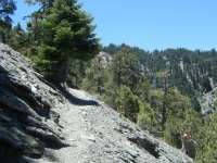
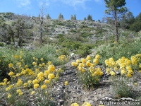
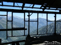
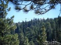
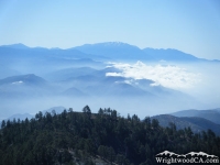
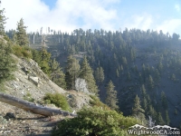
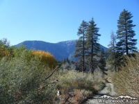
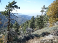
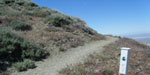 Wrightwood, California is a popular destination for Hikers and outdoor enthusiasts from all over Southern California. The mountainous terrain in the area makes for breathtaking views from many of the local Hiking Trails. The Pacific Crest Trail also runs through the Wrightwood area and hosts thousands of thru-hikers every year. Hiking Trails in Wrightwood offer something for everyone; from easy nature walks to the rugged peaks of the San Gabriel Mountains, Wrightwood's Hiking Trails have it all. See our list of local Hiking Trails below...