Wrightwood CA
Wrightwood CA Weather, webcams, cabins, hotels and more... Elevation: 6,000' Population: 4,525


Replace this Google Ad with your own Advertisement for only $200 per month and be seen on EVERY page!

Circle Mountain


Mountains

Circle Mountain - Wrightwood CA
View Photos (13)
Map of Circle Mountain - Wrightwood CA
View Maps (1)

Circle Mountain Information

Elevation: 6,875'
Location: East of Wrightwood

Circle Mountain Description

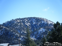
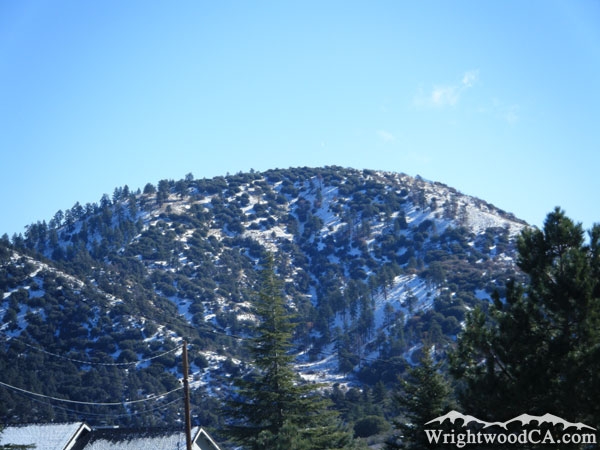
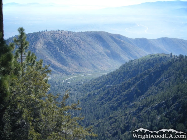
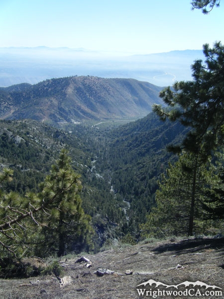
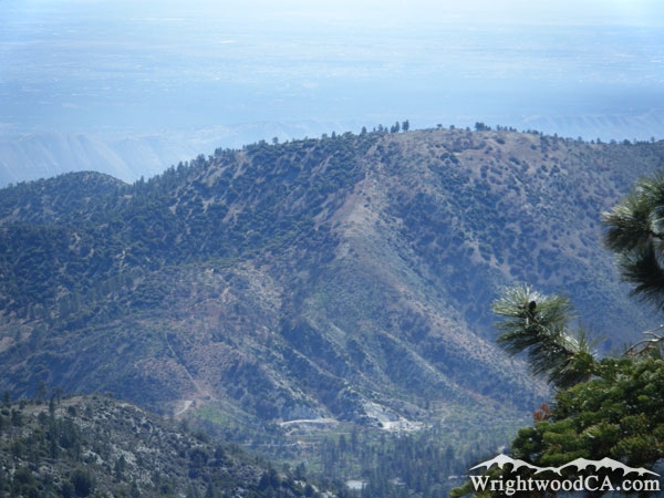
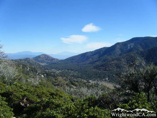
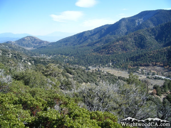
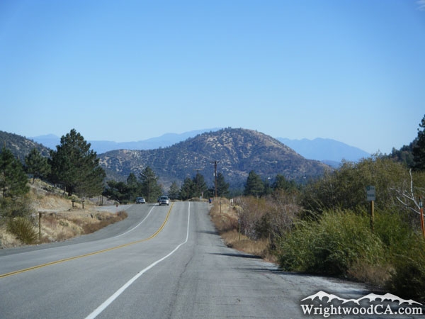
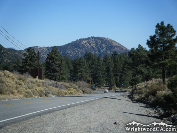
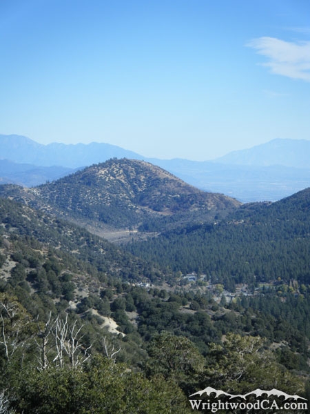
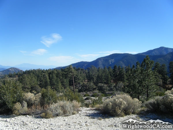
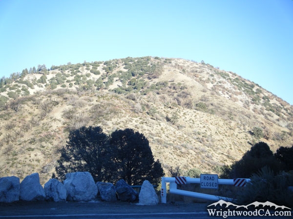
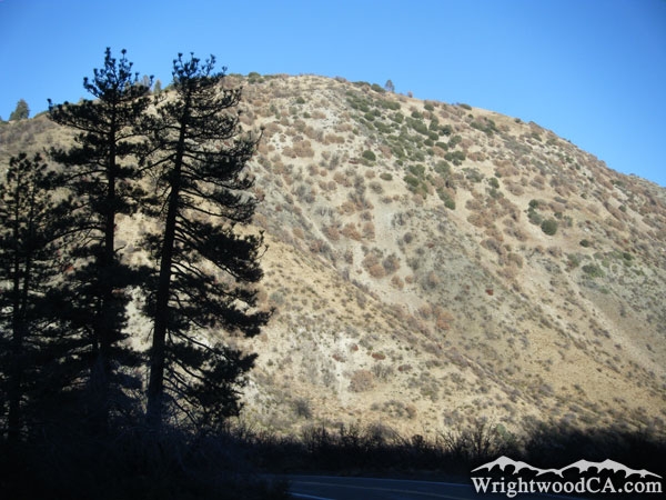
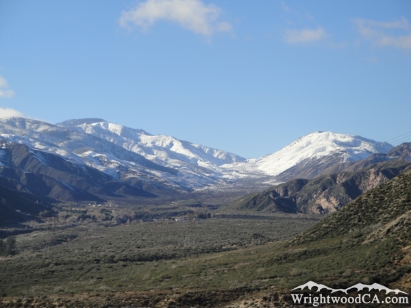
Circle Mountain isn't terribly exciting, however it can be viewed from most areas in Wrightwood. Appropriately named, the rounded hill of Circle Mountain rests at the east end of Swarthout Valley and the north-west end of Lone Pine Canyon. Circle Mountain has a ridge which extends east and makes up the north wall of Lone Pine Canyon. The top of Circle Mountain does offer some amazing views of Lone Pine Canyon, Swarthout Valley (Wrightwood), Table Mountain, and Blue Ridge. If you plan to hike to the top of Circle Mountain, bring a lot of water. The climb is steep, hot and dry. Watch out for Snakes!

For more information, check out our San Gabriel Mountains website on the Wrightwood CA Network.

Directions to Circle Mountain from Wrightwood

From the town of Wrightwood, take Lone Pine Canyon Road eastbound. Once you leave the residential area, there is a turnout near and area known as 'Helicopter Hill'. This is probably one of the closest locations to Circle Mountain. From here, trails can be taken to the peak.

Circle Mountain Photos

Circle Mountain during winter - Wrightwood CA MountainsCircle Mountain above Lone Pine Canyon - Wrightwood CA MountainsCircle Mountain and Slover Canyon - Wrightwood CA MountainsCircle Mountain as viewed from Wright Mountain - Wrightwood CA Mountains
Circle Mountain (top left) at the end of Swarthout Valley - Wrightwood CA MountainsCircle Mountain, Swarthout Valley, and Blue Ridge as viewed from Table Mountain - Wrightwood CA MountainsLooking down Highway 2 at Circle Mountain - Wrightwood CA MountainsCircle Mountain and Highway 2 - Wrightwood CA Mountains
Circle Mountain above Swarthout Valley/Wrightwood - Wrightwood CA MountainsCircle Mountain (far left) and Blue Ridge (right) with Swarthout Valley - Wrightwood CA MountainsCircle Mountain from top of Lone Pine Canyon - Wrightwood CA MountainsBurnt trees in front of Circle Mountain - Wrightwood CA Mountains
Blue Ridge (left), Lone Pine Canyon (center), and Circle Mountain (right) as viewed from 15 Freeway after a big winter storm - Wrightwood CA Mountains

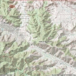
Circle Mountain Maps

Topographic Map of Circle Mountain - Wrightwood CA Mountains


Replace the Google Ad at the top of this page with your own Advertisement for only $200 per month and be seen on EVERY page!

Copyright © 2011-2023 WrightwoodCA.com - All Rights Reserved.
Paid Banner Advertising | Premium Business Listing Service

Wrightwood CA Info: About The Town | Business Directory | Live Webcams | Photo Gallery | Video Archive | Emergency Resources | Maps and Directions | Mountain Road Conditions | Homes and Real Estate | Lodging, Cabins & Hotels | Organizational Camps | Local Campgrounds | Snow Playing | Skiing & Snowboarding | Ziplines at Pacific Crest | Event Facilities | Hiking Trails | San Gabriel Mountains | Canyons and Valleys | Picnic Areas | Visitor Centers