Wrightwood CA
Wrightwood CA Weather, webcams, cabins, hotels and more... Elevation: 6,000' Population: 4,525


Replace this Google Ad with your own Advertisement for only $200 per month and be seen on EVERY page!

Wright Mountain


Mountains

Wright Mountain - Wrightwood CA
View Photos (19)
Map of Wright Mountain - Wrightwood CA
View Maps (1)

Wright Mountain Information

Elevation: 8,505'
Location: South of Wrightwood

Wright Mountain Description

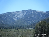
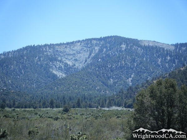
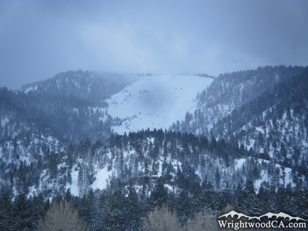
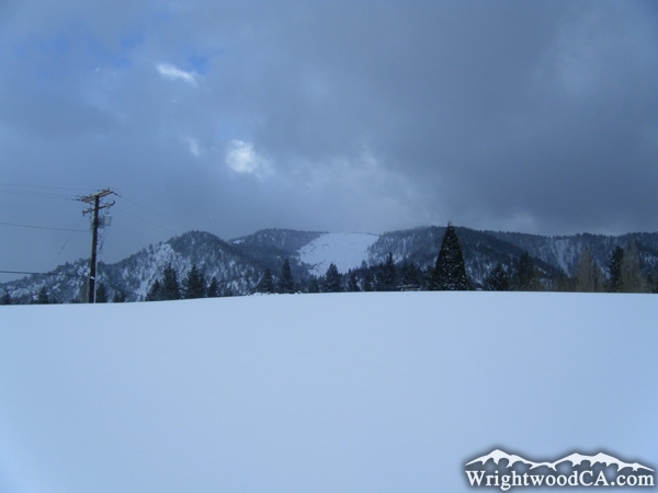
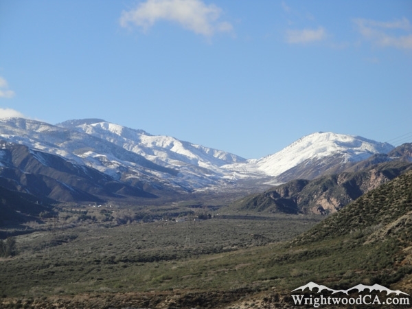
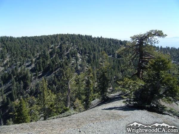
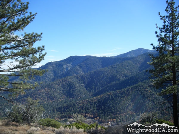
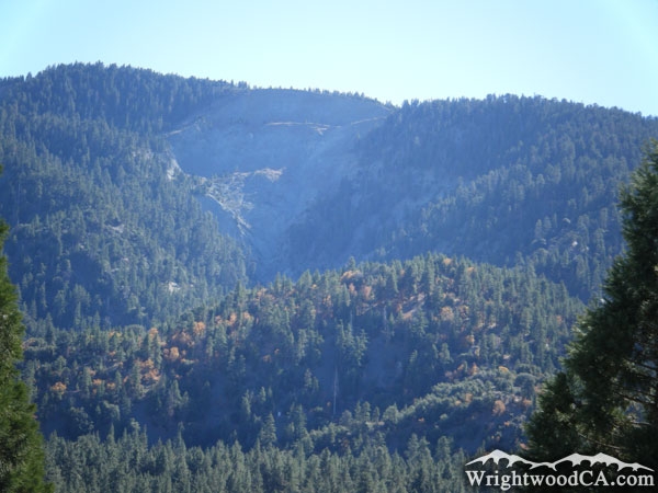
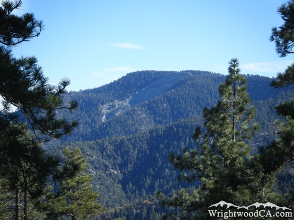
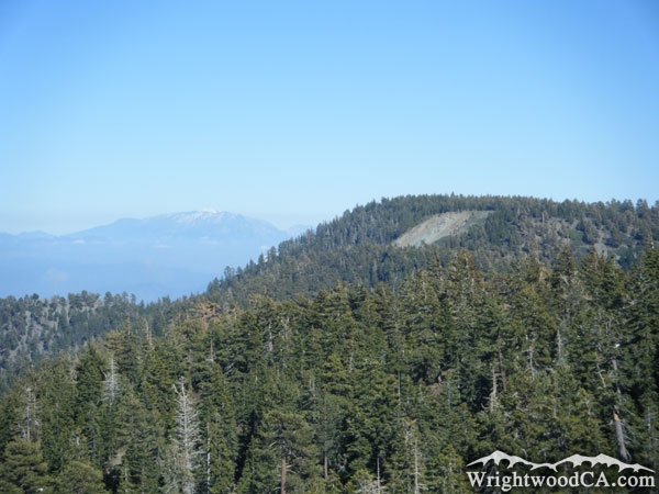
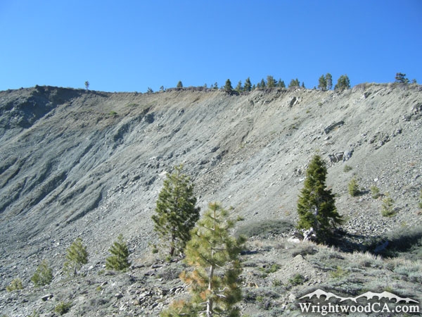
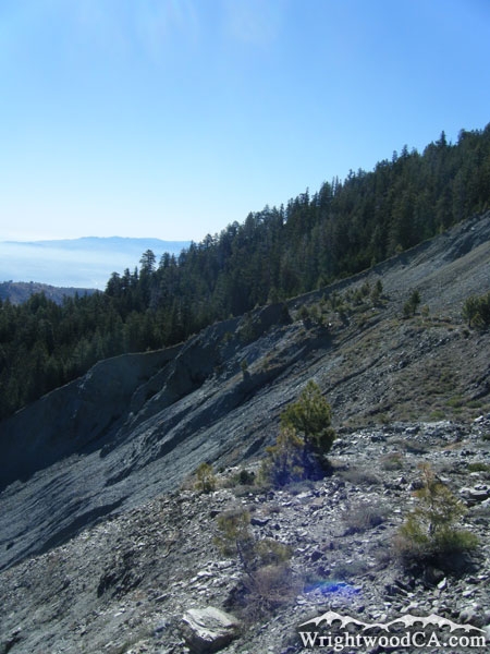
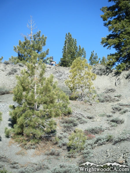
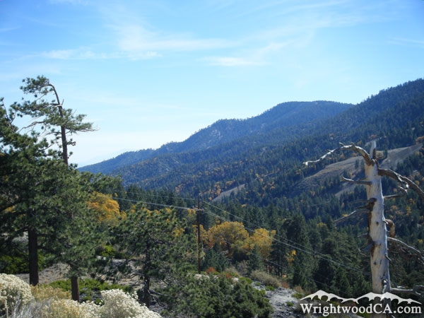
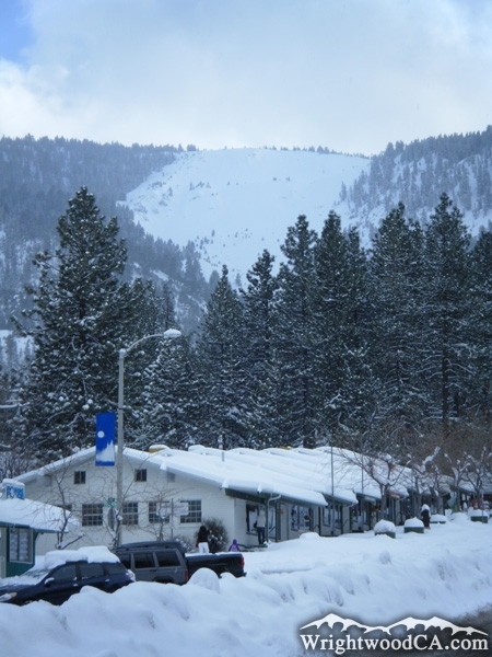
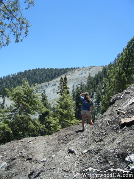
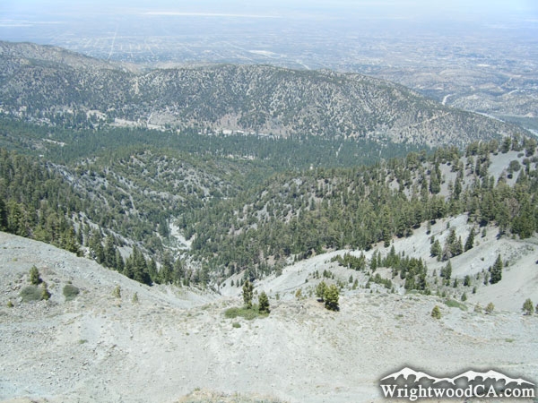
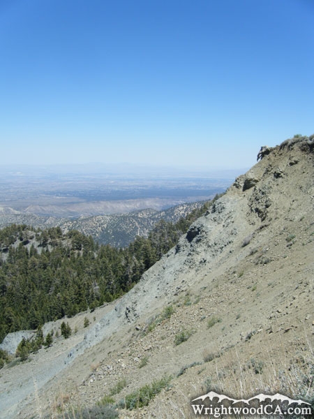
Wright Mountain, at an elevation of 8,505', dominates the skyline along the south side of the town of Wrightwood, California. Wright Mountain is the highest point along the 'Blue Ridge' and can be seen from almost anywhere in the High Desert. Wright Mountain features two giant landslides (Sheep Canyon and Heath Canyon), which are both very recognizable landmarks to the area. Often during large rain storms, both of these canyons cause flooding problems with mud flow which often results in the closure of roads including Lone Pine Canyon Road. The Pacific Crest Trail (PCT) runs along the top rim of Wright Mountain, which offers amazing views, not only of the town of Wrightwood and Swarthout Valley, but of the entire High Desert, Antelope Valley, and San Bernardino Mountains. Wright Mountain is also the trail head to the North Backbone Trail, which runs across Pine Mountain and Dawson Peak to Mt Baldy.

For more information, check out our San Gabriel Mountains website on the Wrightwood CA Network.

Directions to Wright Mountain from Wrightwood

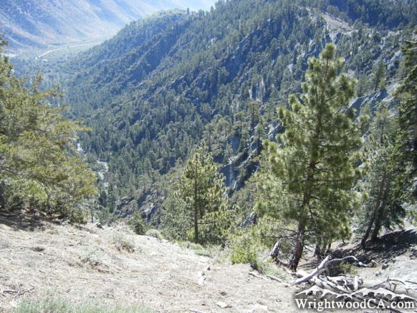
The best place to actually view Wright Mountain is within the town of Wrightwood (Swarthout Valley). To reach the top of Wright Mountain, you can take the Acorn Trail up through Acorn Canyon, which traverses along the side of the Heath Canyon landslide, then follow the southbound Pacific Crest Trail (which actually heads east at this point) to the top of Wright Mountain. Or, if you're up for a scenic drive, take Highway 2 westbound from Wrightwood to Inspiration Point. From Inspiration Point, take the Blue Ridge Road eastbound until you come face to face with the easily recognizable landslide on the side of Wright Mountain; you can't miss it.

Wright Mountain Photos

Wright Mountain - Wrightwood CA MountainsHeath Canyon Landslide on Wright Mountain after winter storm - Wrightwood CA MountainsWright Mountain behind a snow berm after a big winter storm - Wrightwood CA MountainsWright Mountain (left), Lone Pine Canyon (center), and Circle Mountain (right) after a large winter storm, viewed from 15 Freeway - Wrightwood CA Mountains
Looking at backside of Wright Mountain from North Backbone Trail - Wrightwood CA MountainsView of Slover Canyon from Wright Mountain - Wrightwood CA MountainsWright Mountain and Blue Ridge - Wrightwood CA MountainsHeath Canyon Landslide on Wright Mountain in Summer - Wrightwood CA Mountains
Wright Mountain framed by pine trees - Wrightwood CA MountainsSnow on Sheep Canyon Landslide of Wright Mountain - Wrightwood CA MountainsTop of Wright Mountain and Blue Ridge - Wrightwood CA MountainsFace of Heath Canyon Landslide on Wright Mountain - Wrightwood CA Mountains
Landslide on Wright Mountain - Wrightwood CA MountainsTrees near the top of the Landslide on Wright Mountain - Wrightwood CA MountainsLooking down Swarthout Valley with Wright Mountain and Blue Ridge along the right. - Wrightwood CA MountainsLandslide on Wright Mountain after snow storm, viewed from town of Wrightwood - Wrightwood CA Mountains
Acorn Trail switchback that overlooks the landslide on Wright Mountain - Wrightwood CA MountainsLooking down at Swarthout Valley and the town of Wrightwood from the top of the Landslide on Wright Mountain - Wrightwood CA MountainsFace of the landslide of Wright Mountain - Wrightwood CA Mountains

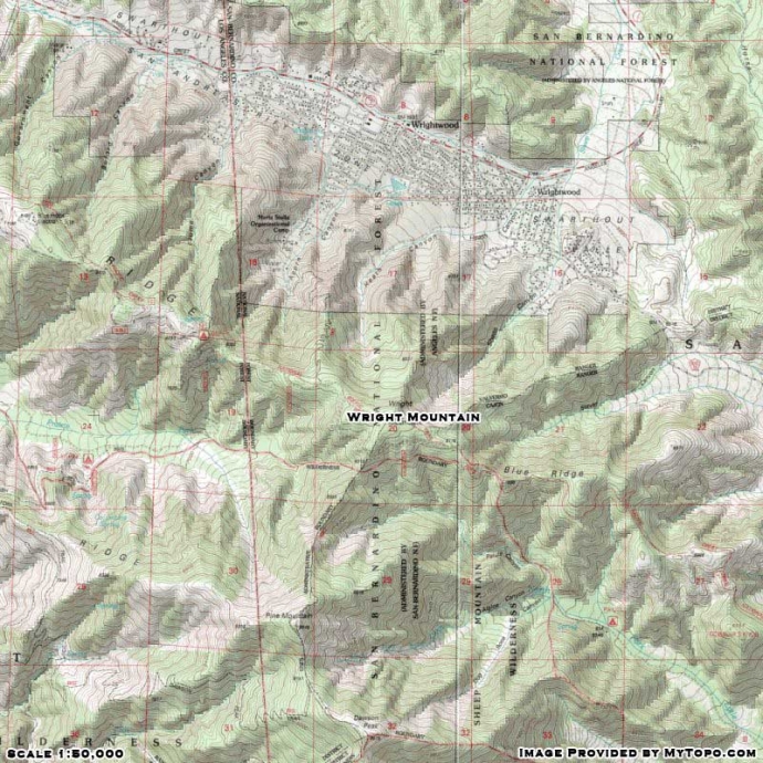
Wright Mountain Maps

Topographic Map of Wright Mountain - Wrightwood CA Mountains


Replace the Google Ad at the top of this page with your own Advertisement for only $200 per month and be seen on EVERY page!

Copyright © 2011-2023 WrightwoodCA.com - All Rights Reserved.
Paid Banner Advertising | Premium Business Listing Service

Wrightwood CA Info: About The Town | Business Directory | Live Webcams | Photo Gallery | Video Archive | Emergency Resources | Maps and Directions | Mountain Road Conditions | Homes and Real Estate | Lodging, Cabins & Hotels | Organizational Camps | Local Campgrounds | Snow Playing | Skiing & Snowboarding | Ziplines at Pacific Crest | Event Facilities | Hiking Trails | San Gabriel Mountains | Canyons and Valleys | Picnic Areas | Visitor Centers