|
 Wrightwood is a small mountain community located high in the San Gabriel Mountains, only about a 90 minute drive from Los Angeles. Due to its central location, Wrightwood is an easy drive, no matter where you're coming from, with minimal mountain driving. During the summer months, Highway 2 (the Angeles Crest Highway) is a common destination for many motorcyclists and other motorists looking for a scenic mountain drive like none other in Southern California. Don't wait any longer, come visit Wrightwood Calif today!
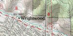
Driving Map from the High Desert to Wrightwood
Driving Instructions from the High Desert to Wrightwood
- From just about anywhere in the High Desert, you can take Interstate 15 southbound (toward San Bernardino) to the Hwy 138 exit.
- From the Hwy 138 exit, take a right and continue for a little over 8 miles to Hwy 2.
- Take a left on Hwy 2 and travel for another 5 miles to the center of the town of Wrightwood, California.
|