Wrightwood CA
Wrightwood CA Weather, webcams, cabins, hotels and more... Elevation: 6,000' Population: 4,525


Replace this Google Ad with your own Advertisement for only $200 per month and be seen on EVERY page!

San Gabriel River Basin (East Fork)


Canyons and Valleys

San Gabriel River Basin (East Fork) - Wrightwood CA
View Photos (10)

View Maps (0)

San Gabriel River Basin (East Fork) Information

Location: South of Wrightwood

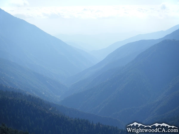
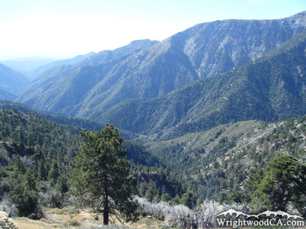
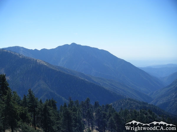
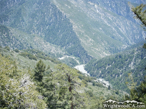
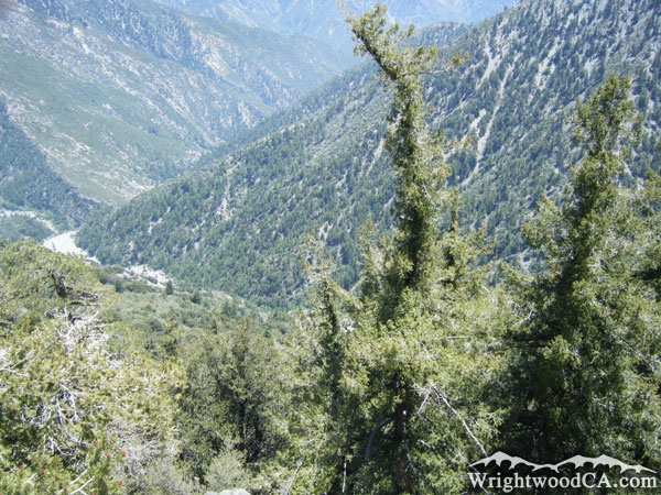
San Gabriel River Basin (East Fork) Description

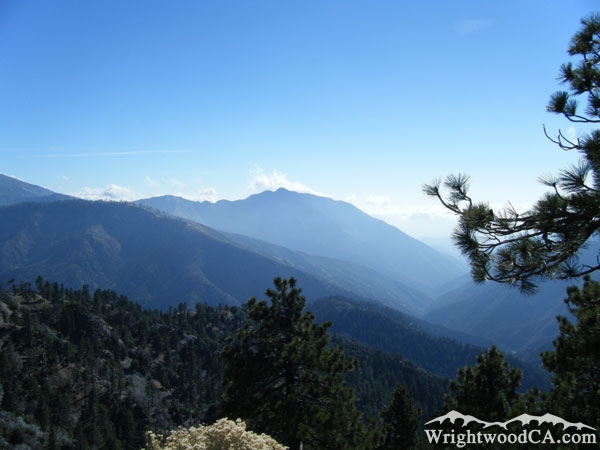
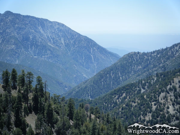
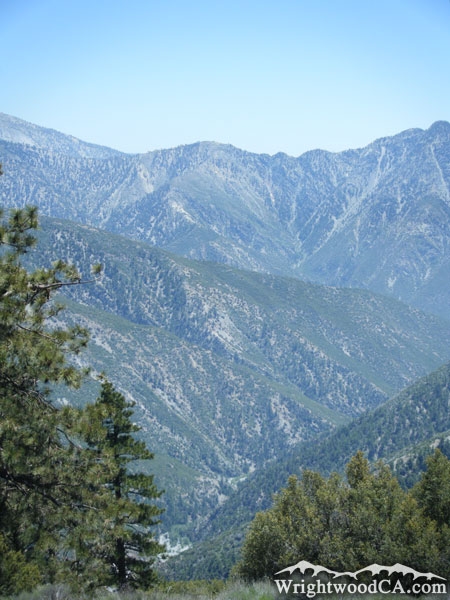
Technically the San Gabriel River Basin (East Fork) encompasses all of the canyons and valleys from the south side of Blue Ridge, the west side of the Baldy Backbone, and the east side of Mt Baden Powell. This would include Mine Gulch, Vincent Gulch, Prairie Fork, Fish Fork, and several smaller canyons that all feed into the same river. The main canyon which hosts the East Fork of the San Gabriel River begins around the base of Pine Mountain Ridge and Mine Gulch. From here, the San Gabriel River winds down past the base of Iron Mountain, under the Bridge to Nowhere, and on to the San Gabriel Reservoir.

Directions to San Gabriel River Basin (East Fork) from Wrightwood

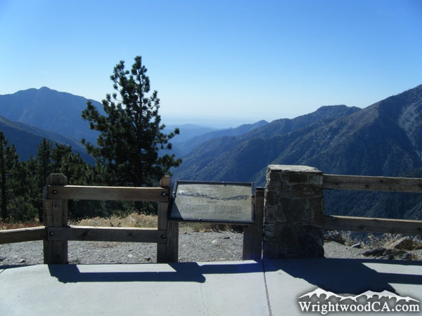
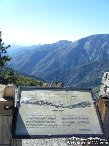
Without question, for the best views of the San Gabriel River Basin (East Fork) you need to take Highway 2 westbound from the town of Wrightwood to Inspiration Point. This allows you to view almost everything the San Gabriel River Basin has to offer. There are, of course, many different angles to view the river basin from just about anywhere in the Sheep Mountain Wilderness, which basically encompasses the San Gabriel River Basin (East Fork).

San Gabriel River Basin (East Fork) Photos

San Gabriel River Basin (East Fork) - Wrightwood CASan Gabriel River Basin where it intersects with Vincent Gulch - Wrightwood CAIron Mountain (left) above San Gabriel River Basin (right) - Wrightwood CALooking down the San Gabriel River Basin (East Fork) from Inspiration Point - Wrightwood CA
Inspiration Point and San Gabriel River Basin - Wrightwood CASan Gabriel River Basin with Pine Mountain Ridge and Iron Mountain in background - Wrightwood CAIron Mountain towering over the San Gabriel River Basin - Wrightwood CASan Gabriel River Basin (East Fork) - Wrightwood CA
Looking down at where the Mine Gulch enters the San Gabriel River Basin, as viewed from Bighorn Mine - Wrightwood CAMine Gulch (bottom) and San Gabriel River Basin (top) - Wrightwood CA

San Gabriel River Basin (East Fork) Maps

This album does not have any photos.


Replace the Google Ad at the top of this page with your own Advertisement for only $200 per month and be seen on EVERY page!

Copyright © 2011-2023 WrightwoodCA.com - All Rights Reserved.
Paid Banner Advertising | Premium Business Listing Service

Wrightwood CA Info: About The Town | Business Directory | Live Webcams | Photo Gallery | Video Archive | Emergency Resources | Maps and Directions | Mountain Road Conditions | Homes and Real Estate | Lodging, Cabins & Hotels | Organizational Camps | Local Campgrounds | Snow Playing | Skiing & Snowboarding | Ziplines at Pacific Crest | Event Facilities | Hiking Trails | San Gabriel Mountains | Canyons and Valleys | Picnic Areas | Visitor Centers