Wrightwood CA
Wrightwood CA Weather, webcams, cabins, hotels and more... Elevation: 6,000' Population: 4,525


Replace this Google Ad with your own Advertisement for only $200 per month and be seen on EVERY page!

Vincent Gulch


Canyons and Valleys

Vincent Gulch - Wrightwood CA
View Photos (12)
Map of Vincent Gulch - Wrightwood CA
View Maps (1)

Vincent Gulch Information

Location: South-West of Wrightwood

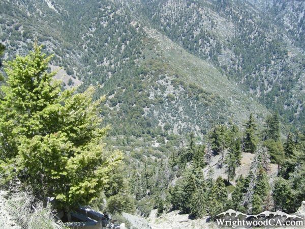
Vincent Gulch Description

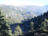
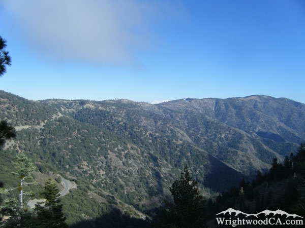
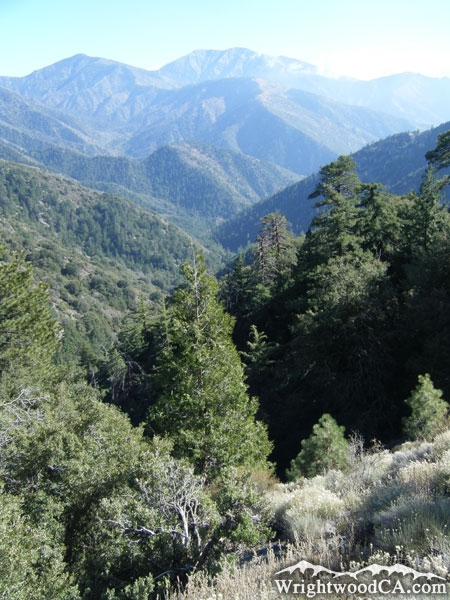
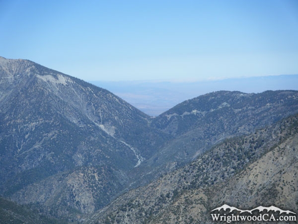
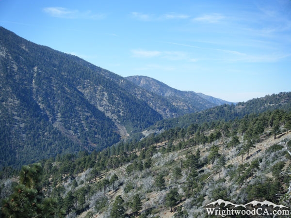
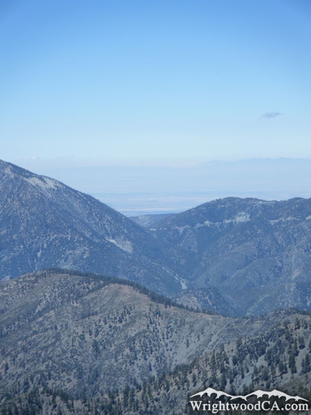
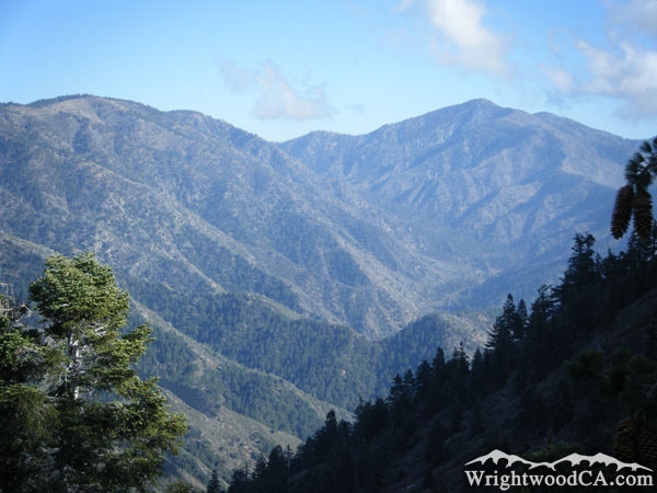
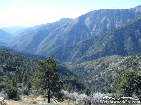
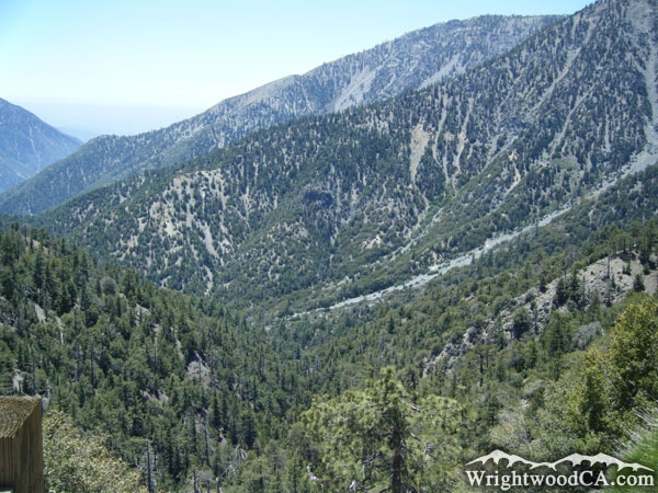
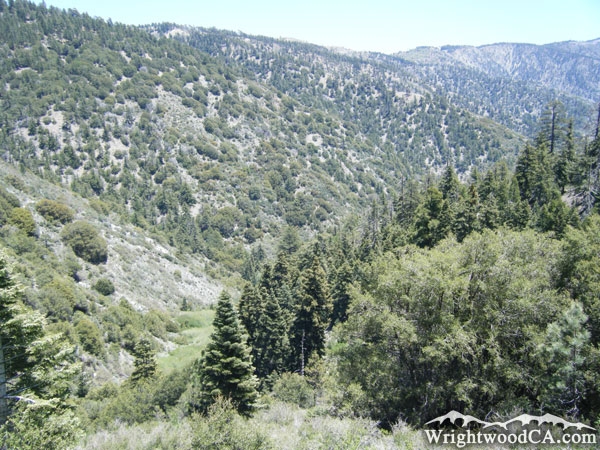
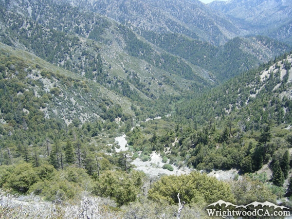
Vincent Gulch is located south-west of the town of Wrightwood, in between Blue Ridge and Mt Baden Powell. Vincent Gulch begins at the Vincent Gap area and drops down into the East Fork of the San Gabriel River, north of Mine Gulch. Vincent Gulch can easily be seen from Inspiration Point. The Mine Gulch Trail actually travels down Vincent Gulch for the majority of the hike.

Directions to Vincent Gulch from Wrightwood

Take Highway 2 from Wrightwood to Inspiration Point for the best views of Vincent Gulch. To experience Vincent Gulch in person, continue down Highway 2 to Vincent Gap. The Mine Gulch Trail will take you from the Vincent Gap Parking (at the base of Mt Baden Powell), down part of the Bighorn Mine Trail, then down into Vincent Gulch. The Mt Baden Powell and Bighorn Mine Trails both offer other views of Vincent Gulch.

Vincent Gulch Photos
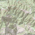
Vincent Gulch below Blue Ridge - Wrightwood CAVincent Gulch below Blue Ridge - Wrightwood CALooking down into Vicnent Gulch from Mt Baden Powell Trail - Wrightwood CAVincent Gulch and Vincent Gap next to Mt Baden Powell, as viewed from North Backbone Trail - Wrightwood CA
Vincent Gulch as viewed from Inspiration Point - Wrightwood CAVincent Gulch behind Pine Mountain Ridge - Wrightwood CAVincent Gulch (bottom) and Prairie Fork (middle) below Pine Mountain (top) - Wrightwood CAVincent Gulch (lower right) where it intersects with the San Gabriel River Basin (East Fork) - Wrightwood CA
Vincent Gulch - Wrightwood CAVincent Gulch as viewed from Bighorn Mine Trail - Wrightwood CALooking down Vincent Gulch from Bighorn Mine Trail - Wrightwood CAVincent Gulch - Wrightwood CA

Vincent Gulch Maps

Topographic Map of Vincent Gulch - Wrightwood CA


Replace the Google Ad at the top of this page with your own Advertisement for only $200 per month and be seen on EVERY page!

Copyright © 2011-2023 WrightwoodCA.com - All Rights Reserved.
Paid Banner Advertising | Premium Business Listing Service

Wrightwood CA Info: About The Town | Business Directory | Live Webcams | Photo Gallery | Video Archive | Emergency Resources | Maps and Directions | Mountain Road Conditions | Homes and Real Estate | Lodging, Cabins & Hotels | Organizational Camps | Local Campgrounds | Snow Playing | Skiing & Snowboarding | Ziplines at Pacific Crest | Event Facilities | Hiking Trails | San Gabriel Mountains | Canyons and Valleys | Picnic Areas | Visitor Centers